
Dunia memang selalu dipenuhi dengan berbagai keindahan. Kali ini kita akan memandang gambar keindahan danau2 yang ada dipelosok bumi.
-Baikal Lake-
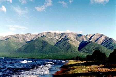

| Coordinates | 53°30′N 108°12′E / 53.5°N 108.2°ECoordinates: 53°30′N 108°12′E / 53.5°N 108.2°E |
|---|---|
| Lake type | Continental rift lake |
| Primary inflows | Selenga, Chikoy, Khilok, Uda, Barguzin, Upper Angara |
| Primary outflows | Angara |
| Catchment area | 560,000 km2 (216,000 sq mi) |
| Basin countries | Russia |
| Max. length | 636 km (395 mi) |
| Max. width | 79 km (49 mi) |
| Surface area | 31,494 km2 (12,160 sq mi) |
| Average depth | 758 m (2,490 ft) |
| Max. depth | 1,637 m (5,370 ft) |
| Water volume | 23,600 km3 (5,700 cu mi) |
| Residence time (of lake water) | 350 years[citation needed] |
| Shore length1 | 2,100 km (1,300 mi) |
| Surface elevation | 456 m (1,496 ft) |
| Frozen | January–May |
| Islands | 22 (Olkhon) |
| Settlements | Irkutsk |

-Five Flower Lake-
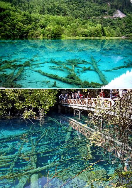
| Location | Sichuan, China |
| Nearest city | Songpan |
| Coordinates | 33°13′0″N 103°55′0″E / 33.21667°N 103.91667°ECoordinates: 33°13′0″N 103°55′0″E / 33.21667°N 103.91667°E |
| Area | 600 to 720 km² |
| Established | 1978 |
| Visitors | 1,190,000 (in 2002) |
| Governing body | Sichuan Provincial Commission for Construction |
-Dead Sea-
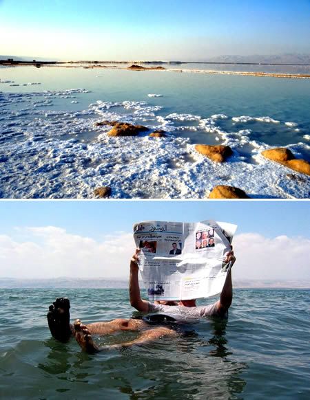

| Coordinates | 31°20′N 35°30′E / 31.333°N 35.5°ECoordinates: 31°20′N 35°30′E / 31.333°N 35.5°E |
|---|---|
| Lake type | endorheic hypersaline |
| Primary inflows | Jordan River |
| Primary outflows | none |
| Catchment area | 41,650 km2 (16,080 sq mi) |
| Basin countries | Jordan Israel West Bank |
| Max. length | 67 km (42 mi) |
| Max. width | 18 km (11 mi) |
| Surface area | 810 km2 (310 sq mi) North Basin |
| Average depth | 118 m (387 ft) |
| Max. depth | 378 m (1,240 ft) |
| Water volume | 147 km3 (35 cu mi) |
| Shore length1 | 135 km (84 mi) |
| Surface elevation | −422 m (−1,385 ft) |
-Laguna Colorada / Red Lagoon-
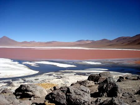

| Location | Potosí, Bolivia |
|---|---|
| Coordinates | 22°11′55″S 67°46′52″W / 22.19861°S 67.78111°WCoordinates: 22°11′55″S 67°46′52″W / 22.19861°S 67.78111°W |
| Lake type | salt lake |
| Basin countries | Bolivia |
| Max. length | 10.7 km |
| Max. width | 9.6 km |
| Surface area | 60 km² |
| Average depth | 35 cm |
| Max. depth | 1.5 m |
| Shore length1 | 35 km |
| Surface elevation | 4,278 m |
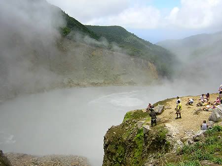

| Coordinates | 15°19′06″N 61°17′39″W / 15.31833°N 61.29417°WCoordinates: 15°19′06″N 61°17′39″W / 15.31833°N 61.29417°W |
|---|---|
| Lake type | flooded fumarole |
| Basin countries | Dominica |
| Max. length | c. 60 m |
| Max. width | c. 60 m |
| Surface elevation | 800 m |
-Plitvice Lakes-
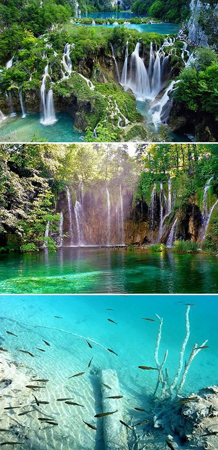
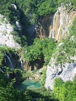
| State Party | |
| Type | Natural |
| Criteria | vii, viii, ix |
| Reference | 98 |
| Region** | Europe and North America |
| Inscription history | |
| Inscription | 1979 (3rd Session) |
| Extensions | 2000 |
| Endangered | 1992-1997 |
Ehm..menarik ya..., kapan kita jalan2 kesana.